
Travel to Pecan Island Along the Louisiana Gulf Coast
Pecan Island is a small community located in extreme south Louisiana about 10 miles from the Gulf coastline, in Vermilion Parish, and near Forked Island and Intracoastal City.
With its prime location between White Lake and the Gulf of Mexico in Vermillion Parish, Pecan Island has become a popular vacation spot for visitors from Lafayette, New Orleans, and Houston who enjoy hunting, fishing, boating and other outdoor recreational activities.
Pecan Island Location and History
It is located on Louisiana Highway 82, southeast of Lake Charles, southwest of Lafayette, and directly south of White Lake.
A "cheniere" is a continuous ridge of beach material built upon swampy deposits, often supporting trees. Pecan Island is a cheniere made up of three sandy ridges covered with pecan and live oak trees. For many years it was an isolated place, difficult to get to, and, because of that, an attractive place for people who wanted to be left alone.
Jacob Cole, from Texas, was the first settler on Pecan Island, in about 1840, looking for grazing land for his cattle.
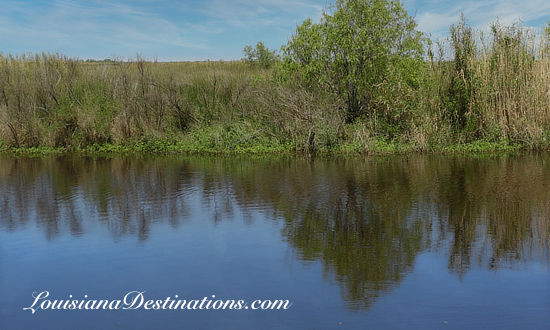 Canal at Pecan Island, Louisiana (Staff Photo) |
Until the 1950s, the only way to get to Pecan Island was by boat from Abbeville, down the Vermilion River, through the Intracoastal Canal, across White Lake, then through narrow canals to a private landing north of the cheniere. A visitor could board the mail boat which made deliveries three times a week and took eight hours, or could hire a "speed boat" which took three hours.
A road was built in 1953 from Little Prairie through Pecan Island, connecting with the Grande Cheniere-Cameron highway. That brought electric power to the region, and telephone service not too long after.
To the west are the communities of Grand Chenier, Creole, Cameron and Holly Beach.
To the north is White Lake, and Vermilion Bay is to the east. Other nearby communities include Abbeville, Intracoastal City, Forked Island, Delcambre, Erath, Kaplan, and Gueydan.
To the west along Highway 82 is located the Rockefeller State Wildlife Refuge and Game Preserve, and to the east is the Russel Sage Foundation Marsh Island State Wildlife Refuge along Vermilion Bay.
The town was ravaged by Hurricane Audrey in 1957, and again by Hurricane Rita in 2005. See article below for details about these hurricanes.
Forked Island, Louisiana
Forked Island, Louisiana, is a small community located on LA Highway 82 near Intracoastal City, between Abbeville and Pecan Island.
There is a high bridge over the Intracoastal Waterway at Forked Island to allow barge traffic to flow underneath the highway. Just to the north is the community of Cow Island.
Before the bridge was built, there was a ferry over the waterway; the ferry landing lies at the end of Cuz Road on the north bank of the waterway.
If you're in Forked Island, stop and eat at the Cajun Diner. The locals get their bait, tackle and other fishing supplies at Maw and Paw's, next door to the diner.
The Forked Island/East Broussard Elementary School, on Columbus Road, serves the educational needs of the area. The Kaplan State Bank has a branch office in Forked Island.
On the south side of the bridge, Pine Island Road runs to the west. Heading south on LA 82, one arrives at Little Prairie, Louisiana, and a crossing over the old Intracoastal Waterway.
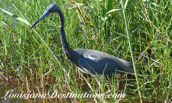
This is a popular area for bird enthusiasts, with a large number of birding locations and rookeries. Depending on the season, the area is home to herons, ibis, Roseate Spoonbills, pelicans, migratory ducks and geese, a variety of songbirds and dozens of other species.
Creole Nature Trail Video ... from Louisiana Travel
Map of Louisiana Gulf Coast from Sabine Pass to Cameron to Pecan Island |
 |
Swamp People and Pecan Island
 |
Pecan Island has been in the news recently due to popularity of the History Channel's hit TV reality series "Swamp People".
Segments are being filmed around Pecan Island, as well as in bayous, lakes and swamps in other parts of South Louisiana such as those near Pierre Part, Bayou Sorrel, Bayou Pigeon, Morgan City and Houma.
The TV series documents a group of alligator trappers during the 60-day Louisiana alligator season in South Louisiana, including the huge Atchafalaya Swamp in the Atchafalaya Basin in south central Louisiana.
Several of the alligator hunters have become TV celebrities, including Troy and Jacob Landry, Elizabeth Cavalier Choate, Bruce Mitchell, Junior Edwards, and others.
After Troy Landry hired her as his helper in Season 2, Elizabeth Cavalier quickly proved her gator hunting abilities, and earned the nickname “Lucky Liz”. A native of Pierre Part and now a resident of Pecan Island, Liz grew up in the marsh south of Houma, and has been around alligators all her life.
 |
In Season 3, Liz began captaining her own boat and hired her friend Kristi Broussard as helper, making them the only all-female alligator hunting team, trapping gators in the swamps near Pecan Island, including the "Monster Marsh". Kristi is a true Cajun, and former Navy veteran, who owns a ranch in South Louisiana where she breaks horses. Kristi was born in nearby Forked Island.
In Season 5 in 2014, Kristi is married and pregnant, so Liz's daughter Jessica is working as helper on Liz's boat. Liz now has a second boat, with her husband Justin as captain, and long-time swamper Glenn Guist as helper.
Swamp People Season 17 is scheduled to debut on the History Channel on January 7, 2026!
Photographs of Pecan Island Louisiana
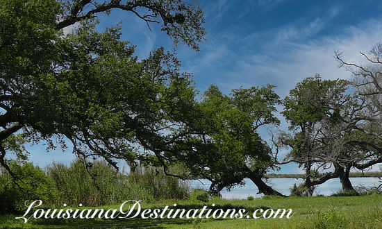
Oak Trees at Pecan Island, Louisiana ... survivors from numerous hurricanes which have struck the area over the decades |
 |
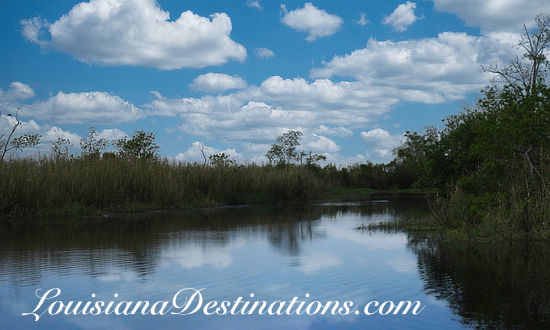
Marsh scene at Pecan Island, Louisiana |
 |
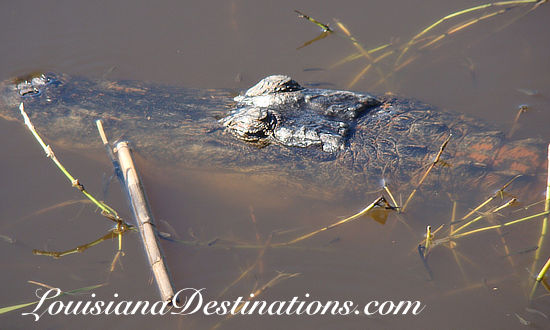
Alligator in a canal at Pecan Island, Louisiana |
 |
Birding paradise near Pecan Island and Forked Island, Louisiana |
 |
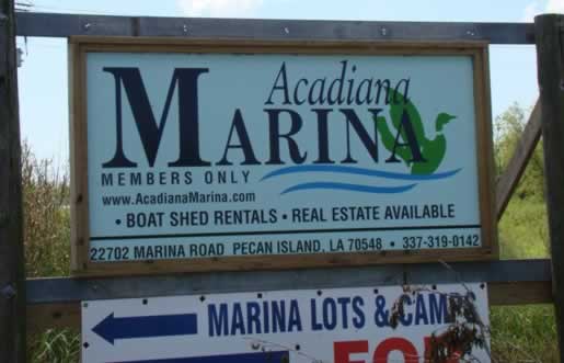
Acadiana Marina, 22702 Marina Road, Pecan Island, Louisiana |
 |
|
Hurricane Impacts Along the Gulf Coast
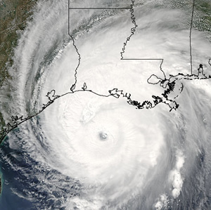 Hurricane Rita approaching the Louisiana Gulf Coast (Photo courtesy of NASA) |
Pine Island and other towns along the central Louisiana Gulf coast have been hit hard by major hurricanes over the decades, including Hurricane Audrey in 1957 and Hurricane Rita in 2005. Both storm names have been retired by the National Hurricane Center as it does for catastropic storms.
Hurricane Audrey
The deadliest natural disaster in the history of Southwest Louisiana struck the coast during the early morning hours of June 27, 1957. An early season hurricane named Audrey roared ashore into Southwest Louisiana and Southeastern Texas. It was the only storm to reach Hurricane Category 4 status in June.
The eye of Audrey made landfall south of Sabine Lake, traversed the lake and then passed over Bridge City, Texas.
Audrey spread a massive storm surge across most of Cameron parish, and across the southern halves of Vermilion, Iberia, and St. Mary parishes, causing total devastation in property and many lives lost.
Damage in Louisiana was catastrophic; 60-80% of the homes and businesses from Cameron to Grand Chenier were either destroyed or severely damaged.
Hurricane Audrey ranks as the 7th deadliest hurricane to strike the United States in modern times, with at least 500 deaths. The exact number will never be known, as many perished in the storm surge in Cameron and Vermilion parishes, and many missing persons were never found.
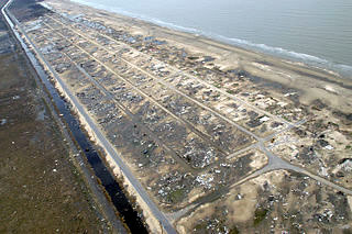 Holly Beach, Louisiana, devastation from Hurricane Rita (Photo courtesy of FEMA) |
Hurricane Rita
Hurricane Rita was the fourth-most intense Atlantic hurricane ever recorded and the most intense tropical cyclone ever observed in the Gulf of Mexico.
Rita caused $12 billion in damage on the U.S. Gulf Coast in September 2005.
Rita made landfall on September 23 between Sabine Pass, Texas, and Johnsons Bayou, Louisiana, as a Category 3 hurricane on the Saffir-Simpson Hurricane Scale with 120 mph winds.
The storm then pushed through parts of southeast Texas. However, the Louisiana coast bore the brunt of the destruction from the always stronger northeast quadrant of the hurricane.
The storm surge caused extensive damage along the Louisiana and extreme southeastern Texas coasts and destroyed some coastal communities.
Several parishes were hard hit, but Cameron Parish was hit the hardest with the towns of Creole, Cameron, Grand Chenier, Johnson's Bayou, and Holly Beach (see photo above right) being totally demolished.
The Plight of Coastal Erosion Along the Louisiana Coast
In the past century Louisiana has lost more than one million acres from its coastal zone because of human and natural factors that have changed the fragile ecosystem. Louisiana supports over 40 percent of the coastal wetlands in the lower 48 states, but has suffered over 90 percent of the coastal wetland loss in the nation.
From places like Cameron and Holly Beach to Pecan Island, to Grand Isle to the east, decades of hurricanes, land subsidence and man's development have taken a toll on the Louisiana coastline. The two hurricanes discussed above, Audrey and Rita, were just two of the massive storms that have pounded the region's fragile ecosystem.
Current Louisiana coastal wetland loss equals 15 square miles/year. This loss rate equals 14,000 football fields annually or one football field every 38 seconds. Between 1932 and 2000, an estimated 1.2 million acres (1,875 square miles) of coastal wetlands were lost.
An estimated 448,000 additional acres (700 square miles) are projected to be lost through 2050.
The State of Louisiana, local parish bodies, and the Federal government through such agencies as the U.S. Fish & Wildlife Service and the Corp of Engineers, have embarked on a series of short-term and long-term projects to control, and reverse, the coastal erosion along the Gulf of Mexico. Projects such as those near Pecan Island utilize terraces in open water to encourage the regeneration of marsh land.
Links of Interest about Louisiana
- History Channel Liz Cavalier Choate "Gator Queen"
- Gator Wrangler Kristi Broussard
- Swamp People on History Channel
- Louisiana Alligator Program at the Louisiana Department of Wildlife & Fisheries
- Louisiana Alligator Advisory Council
- Troy Landry's website ChootEm.com
- Aerial Photography for Swamp People: By Ron Chapple Studios
- Louisiana Film Commission
- Louisiana Alligators
- Louisiana: America's Wetland
- Louisiana Department of Natural Resources
| More Louisiana Travel Information | ||
 |
 |
 |
 |
 |
 |
 |
 |
 |