 St. Philomena Catholic Church, Labadieville, Louisiana |
Labadieville Louisiana
In the heart of Cajun Country and Acadiana, Labadieville is located in south Louisiana on Louisiana Highway LA-1 on the banks of historic Bayou Lafourche. Our family roots are from Labadieville, and nearby Paincourtville, Napoleonville, Plattenville and Thibodeaux.
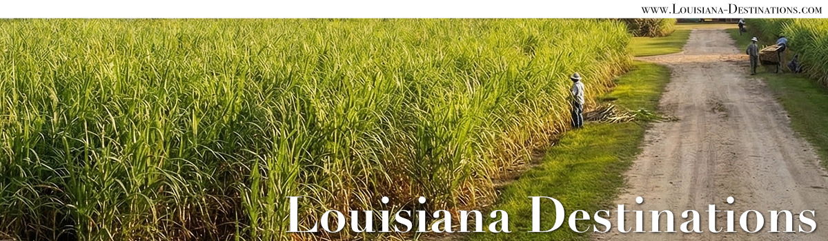
My grandfather worked in the sugar cane fields along Bayou Lafourche, and my ancestors had original land grants in this area. My father was a laborer in the sawmill in nearby White Castle. We are a proud blend of Fremin, Bourg, Boudreaux, Gautreaux, Thibodeaux, and Prejean. Looking back into our ancestry, we have relatives named Aucoin, Herbert, LeBlanc, Jaunet and Girror.
Location of Labadieville
Labadieville is located in Assumption Parish along the banks of Bayou Lafourche, and the home to about 1,800 residents. Labadieville, originally called "Brulee Labadie", takes its name from a French pioneer and resident, Jean Louis LaBadie.
Area communities include Thibodaux, Paincourtville, Plattenville, Raceland, Morgan City, Lockport, Des Allemands, Chauvin, Houma, Pierre Part, and Napoleonville.
 |
Scenes Around Labadieville
St. Philomena Catholic Church is a historic structure, with history dating back to the mid-1700s. Its cemetery is a sacred place, the resting place for generations of Acadians, French, and early Louisiana residents.
In 1843, a mission was established. St. Philomena Catholic church dates from 1848 as an organized parish and the first mass was said in the home of Widow Zacharie Boudreaux. The first building was occupied in 1847.
St. Philomena Rectory |
St. Philomena Cemetery |
Cajun home along the bayou |
The site of our family land grant |
Massive live oak tree along Bayou Lafourche |
|
 |
One of the most popular things to do in Louisiana is touring the swamps!

The lush growth in a Louisiana swamp is indescribable. You have to see it to believe it.
The most impressive objects in the swamp are the cypress trees which are very graceful in their structure, with their reddish bark, exquisitely bent branches, and delicately fine leaves.
Swamp tours are available starting at a number of area communities such as Houma, Thibodaux, Gibson, Kraemer, Patterson, Napoleonville and Theriot.
Learn more about Swamp Tours in Louisiana
 |
Bayou Lafourche is a 106 mile long waterway which stretches from Donaldsonville, at the Mississippi River, to the Gulf of Mexico.
From Donaldsonville, it flows through Paincourtville, Napoleonville, Labadieville, Thibodaux, Raceland, Larose, Cut Off, Galliano, Golden Meadow and finally into the Gulf near Leeville and Port Fouchon.
Originally called the Chetimachas River, it flows through Ascension Parish, Assumption Parish and Lafourche Parish. Many of the early Cajuns settled along the bayou. On the west side of the bayou is Louisiana Highway 1, and on the east bank is LA 308.
The name Lafourche is from the French word for "fork", and comes from the fact that the bayou historically carried a large amount of water from the Mississippi River. Naturally a Mississippi River outlet, Bayou Lafourche was dammed at Donaldsonville in 1905.
The dam cut off nourishment and replenishment of a huge wetland area of south Louisiana, and the bayou was gradually transformed into a stagnant ditch. Today, design efforts are underway to resume part of the flow from the Mississippi River to bring life back to the bayou.
 |
More Photographs of Labadieville
Heading towards Labadieville, Louisiana Photography by the author |
 |
Exterior of St. Philomena Catholic Church Labadieville, Louisiana Photography by the author |
 |
Welcome to St. Philomena Cemetery, established 1841 Labadieville, Louisiana Photography by the author |
 |
St. Philomena Cemetery, Labadieville, Louisiana Photography by the author |
 |
Home in Labadieville, Louisiana, along the banks of Bayou Lafourche Photography by the author |
 |
Naquin Settlement, established September 10, 1785. Land grant by France to Joseph Jacques Naquin, Labadieville, Louisiana Photography by the author |
 |
| Popular Travel Destinations and Tourist Attractions in South Louisiana |
|---|