Tourist Guide for New Roads & Point Coupee Parish
 St. Mary's Catholic Church, New Roads (Courtesy of the Louisiana Office of Tourism) |
New Roads is located on along False River on Louisiana Highway 1 about 30 miles northwest of downtown Baton Rouge, and is the parish seat of Pointe Coupee Parish.
Le Poste de Pointe Coupée (“The Pointe Coupee Post”) is one of the oldest communities in the Mississippi Valley, founded in the 1720s by settlers from France.
The town is named after a “new road” the Spanish built in 1776 between the Mississippi and the False River, northwest from Baton Rouge.
Pointe Coupee Parish is surrounded by three major rivers: the Mississippi on the east, the Atchafalaya River on the west, and the mouth of the Red River on the north. False River is also in the parish.
Old River is a 12-mile long oxbow lake located in northern Pointe Coupee Parish and western West Feliciana Parish.
The population of News Roads is about 4,500 residents. It resides in Area Code 225 and is assigned Zip Code 70760.
False River Regional Airport (HZR) is a general aviation facility that features a 5,003' runway, 40' in width. It is located 2 miles northwest of New Roads.
Nearby communities include Oscar, Rougon, Ventress, Morganza, Jarreau, Torras, Livonia, Erwinville, and Batchelor. St. Francisville is also nearby, across the Mississippi River via the Audubon Bridge.
 |
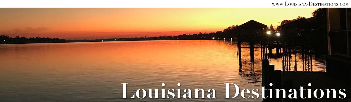
False River
False River is an 11-mile long oxbow lake, covering 3,200 acres, and was formerly the main channel of the Mississippi River until the early 1700s. It has an average depth of 21 feet.
Louisiana Highway 1 runs along the west side of False River, while LA 413 is on the east bank. LA Highway 10 connects New Roads with the Audubon Bridge to the east, and then to U.S. 61 near St. Francsiville.
The location of New Roads on False River makes it a popular locale for weekend camps, summer homes, businesses, outdoor water activities and restaurants.
Fishing, water skiing, sailing and other outdoor recreational activities make New Roads a popular travel destination.
 |
 |
Hotels and B&Bs in the New Roads Area
Several motels, inns, and bed and breakfasts are located in the New Roads area.
In addition, a large variety of accommodations are available in nearby Baton Rouge as well as just across the river in St. Francisville.
River Homes Property Services
River Homes Property Services offers all things to make False River a more enjoyable lake community. The goal of River Homes is to provide a full service, high-quality, customer-oriented experience.
River Homes services include detailed overviews of various properties including data-based rental information, expenses, and other related market information. These reports provide buyers with a simplified, user-friendly overview of top listings.
The staff are natives of Louisiana, have extensive experience in real estate, and know the New Roads and False River area in detail.
The company is strategically located in Oscar, Louisiana, in the center of home rentals and outdoor activities along False River. Among the services the company offers:
- Property rentals and maintenance
- Professional home and property management, plus VRBO Premier Partner Benefits
- Equipment rentals: tables, chairs, kayaks, paddle boards, speakers and much more!
- Unique concierge access: grocery delivery, stocking of home bars & freezers, boat handling, special event setup, catering, transporation ... and more!
- Pier and dock lighting, boat detailing, pressure washing and other professional services
For more information, phone 337.349.2737. Also, be sure to visit the website of River Homes Property Services and River Homes on Facebook
Scenes of homes and boat docks along False River in New Roads, Louisiana Photos courtesy of River Homes Property Services |
 |
 |
 |
Pointe Coupee Parish Courthouse
The Pointe Coupee Parish Courthouse at 201 E. Main Street in New Roads |
 |
Cajun Aces TV Show on the Food Network

The Chefs of Cajun Aces ... Cody and Sam Carroll, owners of the Hot Tails Restaurant in New Roads, Louisiana (courtesy of the Food Network) |
Sam and Cody Carroll of Louisiana premiered their new Food Network show, “Cajun Aces" on December 2, 2017. Their second season aired in the fall of 2018.
Hot Tails in New Roads was the two chefs’ first restaurant, which is located at 1113 Hospital Road. Scenes in the TV series are filmed at the restaurant, and at the family farm in nearby Batchelor.
In the series the married couple tell the story of their cooking ingredients, go harvest the ingredients, cook at the family farm and visit their restaurants.
John James Audubon Bridge
In December 2010, the construction of the John James Audubon Bridge reached a historic milestone with the connection of the two spans, creating the longest cable-stayed bridge in the Western Hemisphere. The bridge was opened on May 5, 2011.
The opening of the bridge closed a St. Francisville and New Roads icon: the ferry which provided regular service across the Mississippi River and connected the east and west bank communities for decades.
The John James Audubon Bridge over the Mississippi River between New Roads and St. Francisville, Louisiana
(Photograph courtesy of the LA Office of Tourism) |
 |
Historic Mississippi River Floods of 1912 and 1927
In 1912, Mississippi River washed through the levee at the community of Torras, creating what would become known as the "Torras Crevasse". Water spread though Pointe Coupee and parishes to the south, including West Baton Rouge, Iberville, Assumption, Lafourche, Terrebonne, St. Martin, Iberia, St. Mary and St. Landry.
New Roads was surrounded with water on three sides, and Morganza and Livonia were under water for weeks. Much of the evacuation of residents and bringing in of supplies were done by trains.
The Great Mississippi Flood of 1927 was the most destructive river flood in the history of the United States, with the Mississippi River swelling to 80 miles in some areas. Part of the flood control projects enacted after 1927 was the Morganza Spillway. Construction of the levees that make up part of the Morganza Spillway began in the late 1930s. The Morganza Control Structure portion of the project was completed in 1954.
Randy Newman sings "Louisiana 1927"
 |
More New Roads Area InformationPointe Coupee Parish Tourism Commission New Roads at LouisianaTravel.com |
| More Louisiana Travel Information | ||
 |
 |
 |
 |
 |
 |
 |
 |
 |